199: NASA Satellites Detect Grapevine Diseases from Space
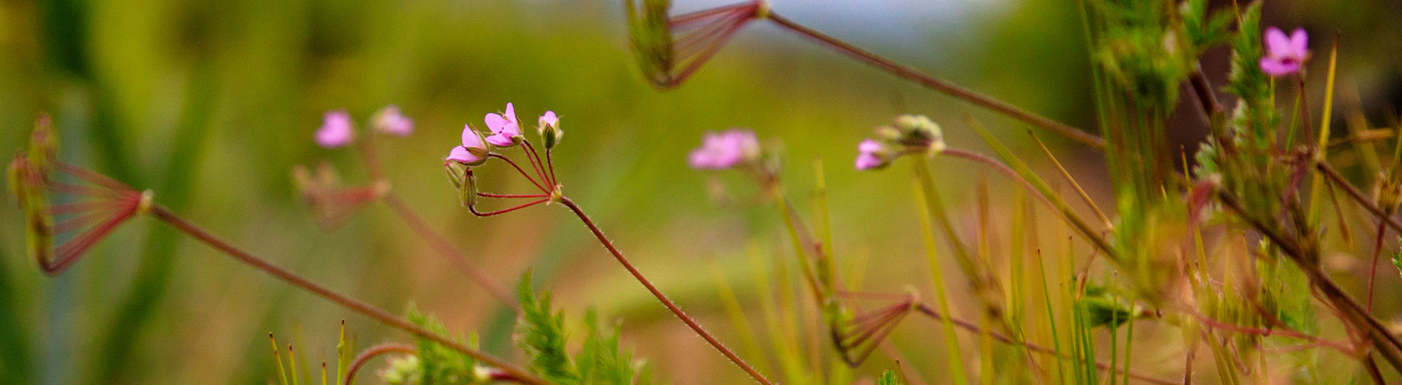
Plants by nature are designed to interact with light. Satellites can measure the light reflected by plants to detect grapevine diseases before they are visible to the human eye. Katie Gold, Assistant Professor of Grape Pathology, Susan Eckert Lynch Faculty Fellow, School of Integrative Plant Science Plant Pathology and Plant-Microbe Biology Section of Cornell AgriTech is trailblazing remote disease detection with imaging spectroscopy also known as hyperspectral imaging.
Imaging spectroscopy was developed by NASA to tell us what Mars was made out of. By turning satellites back on Earth, Katie and a team of scientists are learning how to use the light reflected back to manage grapevine viral and foliar diseases. Listen in to the end to get Katie’s number one piece of advice on the importance of data management.
Resources:
- 191: CropManage: Improving the Precision of Water and Fertilizer Inputs
- Alyssa K. Whitcraft, University of Maryland
- Disease Triangle of Plant Pathology
- Gold Lab
- Katie Gold, Cornell University
- Katie Gold - Twitter
- NASA AVIRIS (Airborne Visible and InfraRed Imaging Spectrometer)
- NASA Acres - applying satellite data solutions to the most pressing challenges facing U.S. agriculture
- NASA Emit Satellite
- NASA JPL (Jet Propulsion Laboratory)
- Planet Labs
Vineyard Team Programs:
- Juan Nevarez Memorial Scholarship - Donate
- SIP Certified – Show your care for the people and planet
- Sustainable Ag Expo – The premiere winegrowing event of the year - $50 OFF with code PODCAST23
- Sustainable Winegrowing On-Demand (Western SARE) – Learn at your own pace
- Vineyard Team – Become a Member
Get More
Subscribe wherever you listen so you never miss an episode on the latest science and research with the Sustainable Winegrowing Podcast. Since 1994, Vineyard Team has been your resource for workshops and field demonstrations, research, and events dedicated to the stewardship of our natural resources.
Learn more at www.vineyardteam.org.
Transcript
Craig Macmillan 0:00
With us today is Katie Gold, Assistant Professor of Grape Pathology at Cornell AgraTech campus of the Cornell University. Thanks for being on the show.
Katie Gold 0:08
Well, thanks for having me.
Craig Macmillan 0:09
Today, we're going to talk about some really cool technology. I've been interested in it for a long time, and I can't wait to get an update on what all is happening. There's some really exciting work being done on using remote sensing for the detection of plant diseases. Can you tell us a little bit about what that research is about what's going on in that field?
Katie Gold 0:25
Sure, what isn't going on in this field, it's a really exciting time to be here. So I guess to put into context, we're really at this precipice of an unprecedented era of agricultural monitoring. And this comes from the intersection of you know, hardware becoming accessible, the data analytics becoming accessible, but also investment, you know, a lot of talk of ag tech being the next big thing. And with that comes this interest in using these cool and novel data streams for disease detection. So my group specializes in plant disease sensing, it's our bread and butter to what we entirely focus on. And we specialize in a technology called imaging spectroscopy for disease detection. So this is also known as hyperspectral imaging. Imaging spectroscopy is the technical term. And this is a type of remote sensing that it differs from, you know, radio wave remote sensing, and it focuses on light in the visible to shortwave infrared range.
Craig Macmillan 1:13
Talk a little bit more about that. So when we talk about hyperspectral, we're looking outside of the range of radiation, essentially, that's not just light.
Katie Gold 1:24
So yes, and no. So hyperspectral is a word that describes how the light is being measured, kind of colloquially, we assigned to it more meaning that it actually has. That's why I often like to differentiate between it for explanation sake, what hyperspectral imaging is, when we talk about using it in the full vSphere range, these are all types of light, you know, it's all aspects of the electromagnetic radiation scale. But this spectrum of light that ranges from the visible to the shortwave infrared, this spans a range of about 2100 wavelengths. So to put that into context, we see visible light only. And this spans a range of wavelengths, that's about 300 nanometers, and went from about 450 to 750. So if you think about all the richness of radiation, the subtlety in differences in color that you see in everyday light, all of that comes from those subtle interactions of, you know, specific wavelengths of light hitting that stuff and bouncing back into our eye. So now imagine having seven times more wavelengths than that, you know, we have 2100, different wavelengths that we measure. And those wavelengths that are beyond the range that we can see the reason why we don't see them as they're less abundant, they're less emitted by our sun, but they're still present, and they still interact with the world. In particular, they interact very strongly with chemistry, such as environmental chemistry. So imaging spectroscopy was developed by NASA to tell us what Mars was made out of, then one day, they're like, let's turn this baby around and pointed at the Earth. And we discovered that it's quite applicable for vegetative spectroscopy. So telling us what vegetation is made of what the composition of the Earth is. And because plant disease impacts chemistry, so dramatically, plant physiology, chemistry, morphology, such a dramatic chaotic impact. It's a really excellent technology to use for early detection. So those subtle little changes that occur within a plant before it becomes diseased to the human eye, but it's undergoing that process of disease.
Craig Macmillan 3:12
Can you expand on that point? Exactly how does this work in terms of the changes in the plant that are being picked up by viewing certain wavelengths? What's the connection there?
Katie Gold 3:23
Consider the leaf, right. So plants are an amazing thing to remotely sense because they're designed by nature to interact with light. Now that's in contrast to skin right that's designed to keep light out plants are designed to have light go in and out, etcetera. So light will enter our atmosphere from the sun, and it will do one of three things when it encounters a plant, it'll be reflected back, it will be absorbed for photosynthesis, or it will be transmitted through the plant. And the wealth of that light is actually reflected back. And that reflected light can be detected by something as distantly placed as a satellite in orbit. And how that light is reflecting off a plant is determined by the health status of a plant. So a healthy leaf, right? It's going to be photosynthesizing. This means that it's going to be absorbing red and blue light for photosynthesis, it's going to have a lot of chlorophyll, it's going to be nice, bright and green, it's going to reflect back a lot of green light. And then it's going to reflect back near infrared light, because that is the sort of light that corresponds really well to the cellular structure of a leaf, right, so a nice healthy leaf is going to bounce back near infrared light. Now an unhealthy plant, it's not going to be photosynthesizing properly. So it's going to be absorbing less red and blue light. Therefore, it will be reflecting more of that red light back, it's not going to have a lot of chlorophyll. So it's going to reflect back less green light, and it's not as healthy. It's not as robust, so it will reflect back less near infrared light. So by looking at those subtle differences, and this is where we get back to that idea of hyperspectral. Right. hyperspectral is a word about how a sensor is measuring light. And hyperspectral means that a sensor is measuring light at such narrow intervals, that it's a near continuous data product. And this is in contrast to a multispectral sensor something Like NDVI that measures light in big chunks. The power is when you have continuous data, right? You could do more complex analyses you just have more to work with. And when you have discrete data, this is what makes hyperspectral sensors more powerful. It's how they're measuring the light, and often, that they're measuring more light that our eyes can see. But that's not necessarily a given hyperspectral sensors do not need to measure beyond the visible range, they can solely be focused on the visual visible range. Because once again, hyperspectral is a word about how the light is being measured. But we oftentimes kind of colloquially, so assign more value to it. But let's take that in combination, right. So you have a hyperspectral sensor that's measuring light and very, very narrow intervals near continuous data product, you're measuring seven times more wavelengths than the eye can see, combined together. That's how this works, right? So those subtle differences and those wavebands how they're reflecting both direct interactions with plant chemistry, you know, some certain wavelengths of light will hit nitrogen bonds go wackadoo and bounce back, all crazy. Otherwise, we're making indirect inferences, right, you know, plant disease as a chaotic impact of plant health that impacts lots of areas of the spectrum. So we're not directly measuring the chemical impact, right? We're not saying okay, well, nitrogen is down two sugars are up three starch XYZ, we're measuring that indirect impact.
Craig Macmillan 6:19
That's pretty amazing. And so...
Katie Gold 6:21
I think it's cool, right? Yeah.
Craig Macmillan 6:24
The idea here is that there are changes in the leaf that can be picked up and these other wave lengths that we wouldn't see until it's too late.
Katie Gold 6:34
Exactly.
Craig Macmillan 6:35
Okay. So it's a warning sign. That gives us a chance to change management.
Katie Gold 6:40
Ideally, so. Right, so it depends on with the scale at which you're operating. So now here comes another level, right. So if you're considering just that one individual plant, it's different from when you're considering the whole scale of a vineyard, right, you want your sensing to be right size to the intervention that you're going to take. So my group works with two types of diseases primarily, we work with grape vine viral diseases, as well as grape vine foliar diseases, for example, a grape vine downy mildew, which is an Erysiphe caused by a Erysiphe pathogen, and grapevine powdery mildew, which is caused by a fungal pathogen. Now the sort of intervention that you would take for those two diseases is very different, right? With a viral disease, the only treatment that you have is removal, there's no cure for being infected with the virus. Now, with a fungal pathogen or an Erysiphe pathogen like grape downy mildew. If you detect that early, there are fungicides you can use with kickback action. Or otherwise, you might change the sort of what sort of choice you might make a fungicide right. If you know there's an actual risk in this location, you might put your most heavy hitting fungicides there than in areas where there is no disease detected, or the risk is incredibly low, you might feel more comfortable relying on a biological, thereby reducing the impact. So given the sort of intervention, you would take, we want to right size, our sensing approach for it. So with grapevine viral diseases, when the intervention is so has such a vast financial impact, right removal, we want to be incredibly sure of our data. So we focused on high spectral resolution data products for that ones, where we have lots of wavelengths being measured with the most precise accuracy so that we can have high confidence in that result, right? We want to give that to someone and say, Hey, we are very confident this is undergoing asymptomatic infection. Now, on the other hand, with these foliar diseases, they change at such a rapid timescale that you're more benefited by having an early warning that may be less accurate, right? So you're saying, hey, this area of your vineyard is undergoing rapid change it might be due to disease might be because your kid drove a golf cart through the vineyard, however, we're warning you regardless, to send someone out there and take a look and make a decision as to what you might do. Ideally, we would have a high spectral resolution regardless, right? Because more spectrum or better, but the realities of the physics and the actual logistics of doing the sensing is that we don't get to do that we have to do a trade off with spectral spatial and temporal resolution. So if we want rapid return, high degrees of monitoring, and we want that high spatial resolution suitable for a vineyard, we lose our spectral resolution, so we lose our confidence in that result. But our hope is that by saying, Hey, this is a high area of change, and giving you that information very quickly, you can still make an intervention that will be yield successful response, right? You'll go out there and you're like, Oh, yep, that's downy mildew. Otherwise, like, I'm going to take my kid keys like he's out here, my vineyard again. Right? So it's, it's kind of work balancing, right. So we have the logistics of the real world to contend with in terms of using sensing to make to inform management intervention.
Craig Macmillan 9:36
This technology can be used or applied at a variety of distances if I understand everything from proximal like driving through a vineyard to satellite.
Katie Gold 9:48
Oh, yeah. And we've worked with everything.
Craig Macmillan 9:50
Yeah, yeah. And everything in between. I mean, could you fly over is a lot of companies that do NDVIs with flyover.
Katie Gold 9:55
You can use robots like we do.
We can use robots, there's all kinds of things we can do. Or what is a what is NDVI for the audience, even though that's not what we're talking about. You and I keep using it.
So NDVI stands for Normalized Difference vegetative index. It's a normalized difference between near infrared light reflecting and red light. And it is probably the most accurate measurement we have of how green something is. And it's quite a powerful tool. As you you know, we've been using NDVI for well over 50 years to measure how green the earth is from space. That's powerful. But the power of NDVI is also its downside. And that because it is so effective at telling you how green something is, it cannot tell you why something is green. Or it cannot tell you why something is not green, it's going to pick up on a whole range of subtle things that impact plant health.
Craig Macmillan 10:40
And whereas the kind of work that you're doing differs from that in that it's looking at different frequencies, and a higher resolution of frequencies.
Katie Gold 10:51
Exactly. So for the most part, we do use NDVI. But we use it more as a stepping stone, a filtering step rather than the kind of end all be all. Additionally to we use an index that's a cousin to NDVI called EDI, that is adjusted for blue light reflectance, which is very helpful in the vineyard because it helps you deal with the shadow effects. Given the trellising system Iin the vineyard. But yes, exactly. We, for the most part are looking at more narrow intervals of light than NDVI and ranges beyond what NDVI is measuring.
Craig Macmillan 11:22
What's the resolution from space?
Katie Gold 11:24
That's a great question.
Craig Macmillan 11:25
What's the pixel size?
Katie Gold 11:27
One of the commercial satellite products we work with has half a meter resolution from space.
Craig Macmillan 11:32
Wow.
Katie Gold 11:33
Yeah, 50 centimeters, which is amazing. Yeah, that was exactly my reaction. When I heard about it, it was like I didn't get my hands on this. But as I mentioned before, right, you know, if that resolution, we trade off the spectral resolution. So actually, that imagery only has four bands, that effectively is quite similar to an NDVI sensor, that we do have a little more flexibility, we can calculate different indices with it. So we use that data product, 50 centimeters, we use three meter data products from commercial sources. And then we're also looking towards the future, a lot of my lab is funded by NASA, in support of a future satellite that's going to be launched at the end of the decade, called surface biology and geology. And this is going to put a full range Hyperspectral Imager into space that will yield global coverage for the first time. So this satellite will have 30 meter resolution. And it will have that amazing spectral resolution about 10 day return. And that 30 meter spatial size. So again, kind of mixing and matching, you don't get to optimize all three resolutions at once. Unfortunately, maybe sometime in my career, I'll get to the point where I get to optimize exactly what I want, but I'm not there yet.
Craig Macmillan 12:41
And I hadn't thought about that. So there's also a there's a time lag between when the data comes in and when it can be used.
Katie Gold 12:48
Yes.
Craig Macmillan 12:48
What are those lags like?
Katie Gold 12:50
It depends. So with some of the NASA data that we work with, it can be quite lagged, because it's not designed for rapid response. It's designed for research grade, right? So it's assuming that you have time, and it's going through a processing stage, it's going through corrections, etc. And this process is not designed to be rapid, because it's not for rapid response. Otherwise, sometimes when we're working with commercial imagery that can be available. If we task it, it can be available to us within 24 hours. So that's if I say, Hey, make me an acquisition. And they do and then within 24 hours, I get my imagery in hand. Otherwise to there's a there's delays up to seven days. But for the most part, you can access commercial satellite imagery of a scene of your choosing, generally within 24 hours of about three meter resolution to half a meter resolution. That is if you're willing to pay not available from the space agencies.
Craig Macmillan 13:42
I want to go back to that space agency thing first or in a second. What talk to me about satellite, we've got all kinds of satellites flying around out there.
Oh, we do.
All kinds of who's doing what and where and how and what are they? And how long are they up there. And...
Katie Gold 13:58
Well, I'll talk a little bit about the satellites that my program is most obsessed with. We'll call it that. I'll first start with the commercial satellite imagery that we use. This comes from Planet Labs. They're a commercial provider, they're quite committed to supporting research usages, but we've been using their data for three years now. Both they're tasked imagery, which is half a meter resolution, as well as their planet scope data, which is three meter resolution. And we've been looking at this for grapevine downy mildew. Planet Labs, their whole thing is that they have constellation architecture of cube sets. So one of the reasons why satellites are the big thing right now they are what everyone's talking about, is because we're at this point of accessibility to satellite data that's facilitated by these advances in hardware design. So one the design of satellites you know, we now have little satellites called CubeSats that are the size of footballs maybe a little bit bigger.
Craig Macmillan 14:48
Oh, really?
Katie Gold 14:48
Yeah, yeah, they're cool. They're cute. You can actually like kids science fair projects can design a CubeSat now, fancy kid school projects, at least not not where I was. As well as constellation architecture. So this is instead of having one big satellite, the size of a bus, you have something like 10, CubeSat, that are all talking to each other and working together to generate your imagery. So that's how you're able to have far more rapid returns, instead of one thing circling around the planet, you have 10 of them circling a little bit off. So you're able to get imagery far more frequently at higher spatial resolution. And this is now you know, trickled down to agriculture. Of course, you know, what did the Department of Defense have X years ago, they've, I'm excited to see what will finally be declassified eventually, right. But this is why satellite imagery is such a heyday. But anyway, that's, that's the whole Planet Labs stick, they use CubeSats and constellation design. And that's how they're able to offer such high spatial resolution imagery.
Craig Macmillan 15:44
Just real quick, I want to try understand this, you have x units, and they're spaced apart from each other in their orbit.
Katie Gold 15:52
That's my understanding. So remember, I'm the plant pathologist here I just usethis stuff. So that's my understanding is that the physicists, you know, and NASA speak, they classify us into three categories. They've got applications, like myself, I use data for something, you have algorithms, which is like I study how to make satellite, talk to the world, right, like, make useful data out of satellite. And then there's hardware people, right, they design the satellite, that's their whole life. And I'm on the other side of the pipeline. So this is my understanding of how this works. But yes, they have slightly different orbits, but they talk to each other very, very like intimately so that the data products are unified.
Craig Macmillan 16:33
Got it. But there's also other satellites that you're getting information from data from.
Katie Gold 16:37
Yes, yeah. So now kind of going on to the other side of things. So Planet Labs has lesser spectral resolution, they have four to eight, maybe 10 bands is the most that you can get from them. We're looking towards NASA surface biology and geology data. And we use NASA's Avaris instrument suite, the family suite, that includes next generation, as well as brand new Avaris three, and this stands for the Airborne, Visible and Infrared Imaging Spectrometer. Now, this is an aircraft mounted device, but this is the sort of sensor that we'll be going into space. Additionally, we're just starting to play around with data from the new NASA satellite called Emit. Emit is an imaging spectrometer that was initially designed to study dust emission. So like, tell us what the dust is made out of where it's coming from. But they've opened up the mask to allow its collection over other areas. And Emit has outstanding spectral resolution, and about 60 meter spatial resolution. It's based on the International Space.
Craig Macmillan 17:32
Station. It's located on the International Space Station?
Katie Gold 17:36
Yes, yeah. And that actually impacts how its imagery is collected. So if you take a look at a map of Emit collections, there are these stripes across the world. And that's because it's on the ISS. So it only collects imagery wherever the ISS goes. And that's a little bit different from this idea of constellation architecture, have these free living satellites floating through orbit and talking to each other.
Craig Macmillan 17:56
Are there other things like Landsat 7, Landsat 8?
Katie Gold 18:02
Oh, we're on Landsat 9 , baby!
Craig Macmillan 18:04
Oh, we're on Landsat 9 now. Cool.
Katie Gold 18:05
Yeah. Yeah, Landsat 9 was successfully launched. I'm really excited about its data.
Craig Macmillan 18:10
And it's coming in?
Katie Gold 18:11
Just to my understanding, yes, so we don't use Landsat and Sentinel data as much otherwise, our focus is on that spectral resolution, but Landsat 9 and its its partner from the European Space Agency's Sentinel 2, they're truly the workhorses of the agricultural monitoring industry. Without those two satellites, we would be in a very different place in this world.
Craig Macmillan 18:32
Right, exactly. Now, you said that your work is funded partially or all by NASA?
Katie Gold 18:37
Yes, partially.
Craig Macmillan 18:38
So partially, so what is the relationship there?
Katie Gold 18:40
So before I started with Cornell, I was hired by Cornell while I was still a graduate student, and as part of their support for my early career development, they sponsored a short postdoc for me a fellowship, they called it I got to stay with a faculty fellow feel better about myself at the Jet Propulsion Laboratory, where my graduate co advisor Phil Townsend had a relationship with so I spent nine months fully immersed in JPL. People think of JPL is like, you know, the rocket launchers, which they are, but they also study, you know, like some of those phase out and go out into the world. But some of the things they launched turn around and study the Earth, and they had the carbon and ecosystem cycling group there. So I was able to work with them, as well as the imaging spectroscopy group for nine months. And it completely changed my entire life just opened up the world to me about what was possible with NASA data, what was coming for potential use of NASA data. And it really changed the trajectory of my career. So I made connections, made friends got my first graduate student from JPL, that have truly defined my career path. So I work very closely with NASA, originating from that relationship, as well as I'm the pest and disease risk mitigation lead for the newly established domestic agriculture consortium called NASA Acres. So this is NASA's most recent investment in supporting domestic agriculture. Through this consortium we're funded to continue some of our research myself and my good colleague, Yu Jiang who's an engineer who builds me my robots. It's confounding our work continuously, as well as giving us the opportunity to try to expand our approach to other domains through interactions, one on one, collaborations with other researchers and importantly work with stakeholders. And this consortium, the Acres consortium is led by my colleague, Dr. Alyssa Woodcraft, based at the University of Maryland.
Craig Macmillan 20:20
Going back to some of the things that you mentioned earlier, and I think I just didn't ask the question at the time, how often does the satellite travel over any particular point on Earth?
Katie Gold 20:32
So it depends on the type of satellite design. Is it the big one satellite sort of design? Or is it constellation? Or the ISS, right? Like they think the ISS orbits every 90 minutes, something like that? So it really depends, but their satellites crossing us overhead every moment. I think at night, if you ever look up into the night sky, and you see a consistent light, just traveling across the world, not blinking. That's a satellite going overhead.
Craig Macmillan 20:59
Wow, that's amazing. Actually, are there applications for this technology on other crops?
Katie Gold 21:04
Oh, certainly. So yeah. Oh, absolutely. So the use of this technology for understanding vegetative chemistry was really trailblaze by the terrestrial ecologist, in particular, the forest ecologist because it's a, you know, it's how you study things at scale, unlike the vineyards would have nice paths between them for researchers like myself, and you know, us all to walk between forests are incredibly difficult to navigate, especially the ones in more remote locations. So for the past two decades, it really spear spearheaded and trailblaze this use, and then I work with vineyards for the most part, I'm a grape pathologist, I was hired to support the grape industry, they saw the research I was doing, they said, great, keep doing it in garpes. So I'm a reformed potato and vegetable pathologist, I like to say, but there's no reason at all why the work I'm doing isn't applicable to other crops. I just happened to be doing it in grape, and I happen to really adore working with the wine and grape industry.
Craig Macmillan 21:54
Yeah, yeah, absolutely. That, it totally makes sense. How is this translating are going to translate for growers into grower practices?
Katie Gold 22:02
That's a great question. So the idea is that by trailblazing these functionalities, eventually, we'll be able to partner with commercial industry to bring this to growers, right. We want these this utility to be adopted for management intervention. But there's only so much one academic lab alone can do and the my role in the world is to trailblaze the use cases and then to partner with private industry to bring it to the people at scale. But the hope is that, you know, I want every venue manager to be looking at aerial images of their vineyards. Every day, right? I have a vision of interactive dashboards, maps of informed risk. One day, I want to have live risk maps informed by remote sensing. And I want every vineyard manager to be as familiar with their aerial view of their vines as they are with that side view of their vines. Right. And I think we're getting there sooner than you realize we're really at the precipice of this unprecedented era of monitoring or monitoring ability, right? And I'm really excited about what it will hold for management.
Craig Macmillan 23:02
And so you must have cooperators I'm guessing.
Katie Gold 23:05
Oh, I do. Yes. I've wonderful cooperators.
Craig Macmillan 23:08
At this stage. It sounds like we're still kind of in a beta stage.
Katie Gold 23:13
Oh, yes, very much in the beta stage.
Craig Macmillan 23:15
So I'm guessing that you're looking at imagery and spotting areas that would suggest that there's some kind of a pathology problem, and then you're going on ground truthing it?
Katie Gold 23:27
So yes, and no, it's more of a testbed sort of case study. We have nine acres of pathology vineyards here at Cornell, Agrotech, and Geneva, New York. And then we do partner with cooperators. We have wonderful cooperators based out in California, as well as here in New York. But those are for more on testbed sort of thing. So we're not just monitoring vineyards, and like watching them and say, Ooh, the spot appears here. We're doing more of a case studies where we intentionally go out and ground truth, then build those links between the imagery because we're not quite there yet, in terms of having this whole thing automated, we're still building those algorithms building that functionality. Now we've established proof of concept. You know, we know this works. So we're working on the proof of practicality, right? Building robust pipelines, ones that are that are resilient to varying environmental geographic conditions, right, different crop varieties resilient to confounding abiotic stress, that one drives us nuts. So that's the stage that we're at, but our collaborators and our industry stakeholders who partner with us. Without them the sort of work I do just simply would not be possible. And I'm extremely grateful for their part.
Craig Macmillan 24:29
So what, what is next, what's next in the world of Katie Gold and in the world of hyperspectral plant pathology?
Katie Gold 24:34
What's next for me is in a week, I'm boarding an airplane to go to Europe for a jaunt. I'm giving two international keynotes at plant pathology conferences about methods but what I really see as next for me is I really want to see the tools that technologies the approach that my group is using, percolate through the domain of plant pathology. We're such a small discipline, there's only about 2000 of us Around the world, in plant pathology, and you know, there's not even 10, great pathologist in this country, I can name every single one of them if you wanted me to. And I think I've got their number and my phone, really, I strongly believe we're at the precipice of such an exciting era in plant pathology, due to the availability of these imagery, these data streams, just simply an unprecedented era. And it will be a paradigm shift in how we ask and answer questions about Plant Pathology, because for the first time, we have accessible, accurate imagery that we can use to study plant disease at the scale at which it occurs in the field in real time. So I want to see these ideas percolate through the skill sets adopted, taken up and embraced and it we're seeing that start, you know, we're seeing that start, there's really excitement in plant pathology, about the use of remote sensing about GIS and that skill set in its value to our discipline. But I'd really like to see that expand. I think I am the first ever plant pathologist to receive funding from NASA Earth Science Division. When I started at JPL, they would introduce me as a disease ecologist, because no one had ever heard of plant pathology. And my wonderful colleague at JPL, Brian Pavlik, who's a JPL technologist, when we started working together, he had never once been into a vineyard. He didn't know about Plant Pathology, he was the one that called me a disease ecologist. And recently, I heard him explain the disease triangle to someone, which is, of course, the fundamental theory of plant pathology. And I was just so proud. But it also really represented this real excitement for me this embrace this acknowledgement of the challenges we face in plant pathology in these domains that otherwise have not heard of us, right and beyond the USDA, funding from NASA, just awareness from these other organizations, excitement from engineers, AI experts about solving plant disease problems. It's truly invigorating and exciting to me. That's where I see you going next. And I'm really excited about the future.
Craig Macmillan 26:51
There was one thing that you could say to grape growers on this topic, what would it be?
Katie Gold 26:58
Oh, that's such a great question. There's so much that I want to say.
Craig Macmillan 27:01
One thing, Katie.
Katie Gold 27:04
I would say your data is valuable and to be aware of how you keep track of your data, that the keeping track of your data, keeping your data organized, keeping, just having reproducible organized workflows will enable you to make the most out of these forthcoming technologies. It will enable you to calibrate it will enable you to train these technologies to work better for you, but your data is valuable, don't give it away to just anyone and to be aware of it.
Craig Macmillan 27:33
I agree wholeheartedly. And I think that applies everything from how much time it takes to leaf an acre of ground. And how much wood you are removing when you prune to when and how much water you're applying. Data is gold.
Katie Gold 27:49
Data is gold.
Craig Macmillan 27:50
It takes time and energy.
Katie Gold 27:52
Institutional knowledge. For example, my field research manager Dave Combs has been doing this job for over 25 years, I inherited him from my predecessor, and he trained our robot how to see disease in its imagery. And the goal of our robots is not to replace the expertise like Dave, but to preserve them right to preserve that 25 years of knowledge into a format that will live beyond any of us. So I see keeping track of your data keeping track of that knowledge you have, you know, you know, in your vineyard where a disease is going to show up first, you know your problem areas, keeping track of that in an organized manner, annotating your datasets. I'm starting to adopt GIS in a way just simply like, here are my field boundaries, even simply just taking notes on your in your data sets that are timed and dated. I think it's incredibly important.
Craig Macmillan 28:38
Where can people find out more about you and your work?
Katie Gold 28:41
Well, so you can visit my Web website or I've got a public Twitter page where you can see me retweet cool things that I think are cool. I tweet a lot about NASA I tweet a lot about Greek disease. If you want to see pictures of dying grapes come to my Twitter page, as well as Cornell regularly publishes things about me.
Craig Macmillan 28:57
Fantastic.
Katie Gold 28:58
So be sure to Google Katie Gold Cornell.
Cornell that's the key. Yeah, Katie go to Cornell or you might get an unwelcome surprise.
Craig Macmillan 29:04
And we have lots of links and stuff on the show page. So listeners you can go there. I want to thank our guest today.
Unknown Speaker 29:13
Thank you so much for having me, Craig. This has been wonderful.
Craig Macmillan 29:16
Had Katie Gould, Assistant Professor of rape pathology at Cornell agritech campus of Cornell University.
Nearly Perfect Transcription by https://otter.ai